Mobile LiDAR Applications for Highway Surveys in Canada
Detailed Corridor Data for Highway Engineering
Mobile LiDAR applications for highway surveys give engineering teams a detailed view of road surfaces, structures and roadside features. For projects across Canada, this information can inform widening, interchange reconstruction and rehabilitation while reducing the time survey crews spend beside live traffic.
The value extends beyond scanning. When combined with precise survey control, reliable field verification, and conventional measurements, mobile LiDAR produces a dataset design engineers can use for base mapping, terrain models, and design coordination.
What Is Mobile LiDAR?
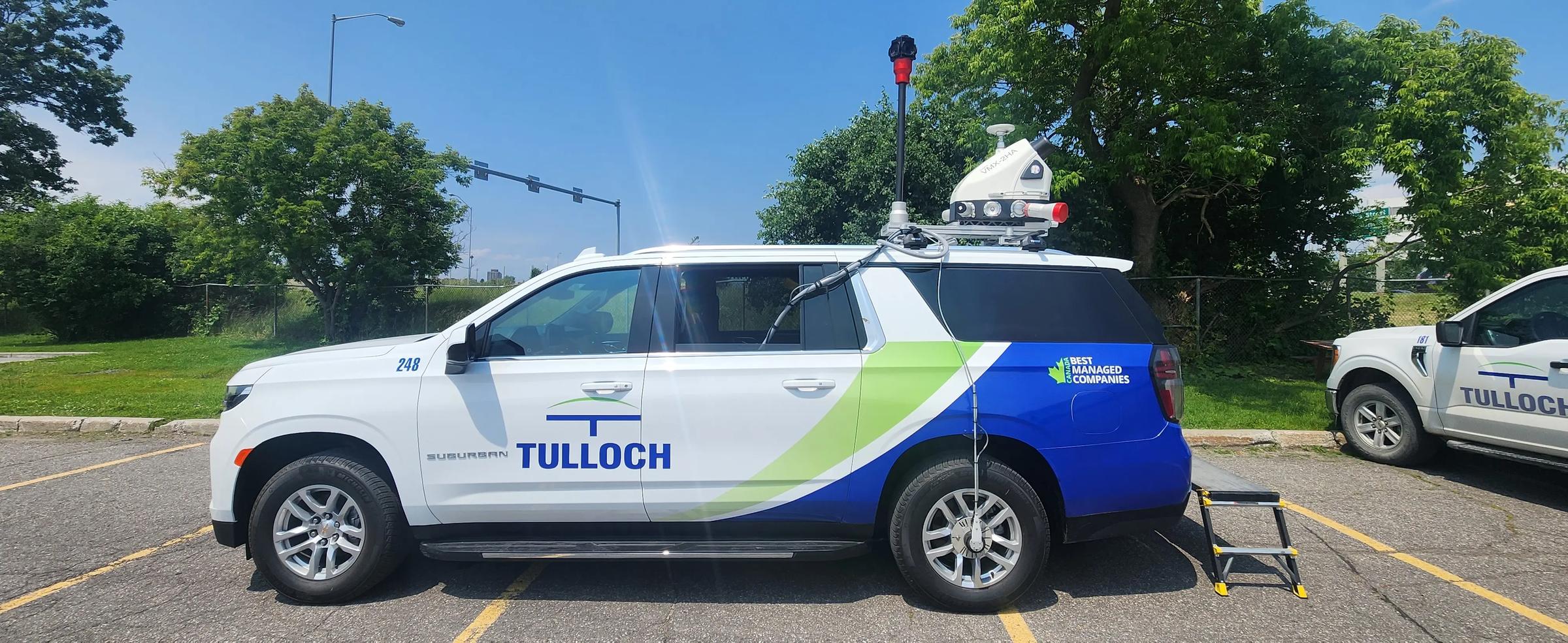
Mobile LiDAR, or light detection and ranging, uses vehicle-mounted laser scanners to measure surrounding surfaces as the vehicle travels. Satellite positioning and motion sensors locate these measurements in three dimensions, creating a dense collection of points called a point cloud.
Also known as mobile laser scanning, this form of 3D laser scanning records visible road geometry and surrounding features along a corridor. The point cloud becomes a source for measurements, mapping and models.
A paper available through the Transportation Association of Canada demonstrates how mobile LiDAR data can support highway sight-distance assessments, using a section of Alberta’s Highway 36.
Mobile LiDAR Applications for Highway Engineering Surveys
Existing-Condition Mapping
Highway engineering begins with understanding what exists. Mobile LiDAR captures pavement, shoulders, curbs, barriers and other visible features that shape widening or rehabilitation decisions.
Surveyors combine these observations with field measurements to develop an existing-condition record. This is particularly useful where older drawings do not reflect current road geometry or later improvements.
Base Plans, Profiles and Digital Terrain Models
Processed point clouds provide measurements for engineering base plans, profiles and cross-sections. Survey teams extract features and surface changes to create digital terrain models, or DTMs, that represent ground elevations.
These deliverables allow designers to assess grades, drainage and connections to existing roads. Vegetated shoulders, concealed features and gaps in scan coverage require additional observations before the ground model is complete.
Bridges, Overpasses and Interchanges
At interchanges and bridge approaches, multiple road levels, ramps and structures must fit within one coordinated survey framework. Mobile LiDAR records visible surfaces and geometry along the vehicle’s route.
Project teams can use the resulting information to assess connections, clearances and spatial constraints. Areas hidden beneath structures or beyond the scanner’s view require targeted measurements using complementary survey methods.
Asset and Roadside Feature Mapping
Point clouds can document signs, light poles, barriers, drainage inlets and other visible roadside assets. Extracted features can feed CAD drawings or GIS inventories, depending on the project’s requirements.
Surface scanning does not locate buried utilities. Utility mapping combines visible evidence with records, locating methods and field verification appropriate to the assignment.
Mobile LiDAR Highway Surveys in Ontario
TULLOCH’s highway survey work in Ontario demonstrates how mobile LiDAR fits into engineering assignments. These projects combine corridor capture with control, conventional surveying and deliverables prepared for the design team.
Highway 401 Expansion, Tilbury to London
For the Highway 401 Expansion, Tilbury to London, Stantec retained TULLOCH as Engineering Survey Lead. The wider program addressed approximately 116 kilometres of highway, including interchange, structure and safety improvements.
TULLOCH surveyed hard surfaces using mobile LiDAR and integrated the results with ground survey and photogrammetric data. Deliverables included Civil 3D base plans and profiles in the required ETR plate format.
Highway 400 and Dunlop Street Interchange
On the Highway 400 and Dunlop Street Interchange Reconstruction in Barrie, TULLOCH served as Engineering Survey Lead for McIntosh Perry.
The team combined mobile LiDAR and ground surveys to document the highway and interchange. Control verification, right-of-way calculations and Civil 3D base plans and profiles provided the survey information needed for reconstruction design.
QEW Garden City Skyway Bridge Twinning
For the QEW Garden City Skyway Bridge Twinning, TULLOCH served as Project Surveyor and GIS Specialist within the Owner’s Engineer team.
The assignment combined geodetic control, mobile LiDAR and ground surveys with property information and GIS tools. Civil 3D base plans and profiles brought the survey datasets together for the bridge and surrounding corridor.
Mobile LiDAR Scanning for Toronto Freeway Infrastructure
Toronto roadway surveys must account for heavy traffic, restricted access and infrastructure occupying several levels. Capturing these relationships gives designers a clearer basis for planning rehabilitation.
For the Gardiner Expressway Rehabilitation, TULLOCH acted as Engineering Survey Lead for Morrison Hershfield. Mobile LiDAR captured hard surfaces, while terrestrial scanning, ground surveys and Don River bathymetry provided complementary information.
The team prepared MicroStation base plans and accompanying InRoads DTM files to City of Toronto requirements. Legal surveys documented right-of-way limits and informed Reference Plans for property acquisition. The work illustrates how a coordinated survey program delivers more than a point cloud.
Why Use Mobile LiDAR on Active Highway Corridors?
Mobile LiDAR can shorten corridor data collection and reduce the need for individual measurements beside moving traffic. Research available through the Transportation Association of Canada on mapping overhead highway assets with mobile LiDAR describes how vehicle-based scanning can collect detailed information while limiting disruption to traffic.
- Reduced field exposure: Vehicle-based capture limits some work that would otherwise take place on foot near traffic.
- Less traffic disruption: Suitable assignments may require fewer lane closures for data collection, subject to access and traffic management requirements.
- Detailed corridor coverage: Closely spaced observations record visible surfaces along the route and their relationship to nearby infrastructure.
- Reusable information: Teams can revisit the point cloud to extract additional features within the original coverage and accuracy limits.
- More efficient design coordination: A shared spatial record allows engineers to examine existing geometry and resolve questions with fewer return visits.
Reuse still requires judgment. Data represents conditions at the time of capture, so construction changes or newly obstructed areas may require another survey.
Combining Mobile LiDAR with Conventional Surveys
Mobile LiDAR does not replace conventional surveying. TULLOCH combines these methods through its geomatics engineering and land surveying services, using GNSS positioning, total stations, and levelling as the assignment requires.
Survey control places the datasets in a common coordinate system and vertical datum. Independent ground checks verify the processed results, while targeted fieldwork captures missing features. Legal surveys establish property information where boundaries or acquisition requirements affect the corridor.
Mobile LiDAR can meet engineering survey requirements when collection, control, processing, and verification are designed to meet the required tolerances. Accuracy depends on the whole workflow, including positioning conditions, scanner range, obstructions and control quality. Point density alone does not establish accuracy.
Ontario’s Ministry of Transportation publishes an Engineering Survey Manual as a provincial reference for engineering survey work. Survey methods, accuracy requirements and deliverables should follow the applicable agency and contract requirements for each assignment.
The capture method also depends on access and terrain. On Highway 3 Widening and Twinning, Talbotville to St. Thomas, TULLOCH combined conventional engineering surveys with aerial LiDAR to address permission-to-enter constraints. That assignment demonstrates method selection, rather than a mobile LiDAR application.
TULLOCH’s broader mobile, aerial and terrestrial LiDAR services allow complementary capture methods where needed. Water crossings may also require bathymetric surveying, selected to suit the water conditions and required detail.
From Point Clouds to Engineering Deliverables
A point cloud is the starting dataset. Survey specialists align the observations, check them against control, remove unwanted returns and extract the features needed for the assignment.
The resulting package may include:
- CAD base plans with roadway and roadside features.
- Profiles, cross-sections and digital terrain models.
- Drawings and surfaces prepared for Civil 3D or MicroStation workflows.
- Point clouds and GIS datasets for coordination or asset management.
- As-built records or construction verification outputs where the survey scope and tolerances allow.
Confirming file formats, reference systems, feature requirements and accuracy criteria before collection makes the results easier to integrate into the design team’s workflow.
TULLOCH’s Mobile LiDAR Experience
TULLOCH established its Mapping team in 2011, focusing on mobile LiDAR engineering surveys for highways and rail. Early adoption and continued development of hybrid survey methods have shaped how the team combines scanning, field measurements and data processing.
Today, mobile LiDAR scanning forms a key part of TULLOCH’s approach to transportation projects. Work on major highway and rail corridors combines detailed capture with survey control and verification to deliver accurate, engineering-ready information for project teams.
TULLOCH’s Toronto and Ottawa offices serve as bases for mobile LiDAR and highway engineering survey work, connecting field data collection with mapping and technical expertise for transportation projects.